Field Tests and Representative Sampling
Use a simple field kit, test pans, classification, notes, photos, and repeatable samples without fooling yourself.
By the end of this module
- Build a compact field kit
- Collect representative samples
- Record observations another person can reproduce
You dug a hole, panned it down, and got three flecks of color. Was that spot actually good, or did you just get lucky on one pan out of a deposit that’s mostly barren? Without a system, you can’t tell the difference — and that’s the entire point of this module. Field testing isn’t about one dramatic result; it’s about a repeatable routine that tells you the truth even when the truth is “nothing here.”
The Core Toolkit, Recapped and Put to Work
Module 1 introduced the individual tests. This module is about running them as a routine, every time, on every site.
- Hand lens (10x loupe) — for examining grain shape and rounding (angular vs. rounded, informing the till/outwash/alluvium call from Module 4), mineral habit, and fine texture invisible to the naked eye.
- Scratch (hardness), streak, and acid tests — as detailed in Module 1, run as a standard sequence rather than a one-off check when something looks promising.
- Field notebook — records location, date, sample description, and test results for every site, building both a personal prospecting record and, if it’s ever needed, supporting documentation.
The Pan Test — Your Fundamental Sampling Method
The pan test is the foundational placer-prospecting technique. Fill the pan with gravel and sand from a target layer — ideally near or on bedrock or false bedrock, per Module 5’s discussion of where gold actually settles. Submerge and agitate the pan in water, allowing lighter material to wash off while denser material, including gold and “black sands” (largely magnetite), concentrates at the bottom.
Classification — Screen Before You Pan
Classification (sizing/screening) means sieving raw material through graduated screens before panning. This removes oversize rock, speeds up the panning process, and — as a bonus — helps you assess the grain-size distribution of the material, which is a direct clue to whether you’re dealing with a sorted deposit (outwash, alluvium) or an unsorted one (till, colluvium), tying straight back to Module 4.
Building a Field Notebook Template
A good field notebook records enough detail that someone else — or you, six months later — could find the same spot and repeat the same test. The University of Kansas DIY mineral ID kit format is a solid practical model: numbered specimens with a simple table tracking color, luster, streak, hardness, and acid reaction (DIY Mineral ID Kit, University of Kansas). Extend that same logic to sample sites:
| Field | What to record |
|---|---|
| Location | GPS coordinates plus a written description tied to a topo map (Module 8) |
| Date | |
| Deposit type | Till / outwash / alluvium / colluvium / etc. (Module 4) |
| Depth sampled | Especially depth relative to bedrock or false bedrock |
| Grain size / sorting | From classification screening |
| Test results | Streak, hardness, acid reaction, magnetism |
| Pan result | Color count, black sand volume, any notable minerals |
Representative Sampling — Don’t Fool Yourself
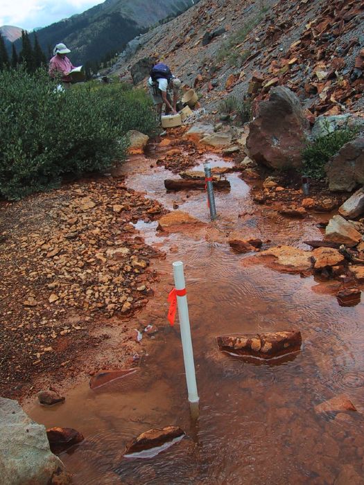
This is the single most important habit in this module. Sample across the width and depth of a target deposit, not just the most visually promising spot, and take multiple samples per site before drawing conclusions about a pay streak’s extent. Module 5 already made this point about pay streaks specifically — narrow, discontinuous, and easy to misjudge from one lucky pan. The fix is the same one used in any honest field science: replicate before you conclude.
A practical minimum: don’t call a site “good” or “barren” off a single pan. Take samples from at least three or four distinct locations or depths, and look for a consistent pattern rather than a single outlier in either direction.
Safety in the Field
Recreational prospecting under Casual Use (see Module 8) is generally low-risk, but a few specific hazards deserve real attention, not an afterthought:
- Cave-in risk. BLM explicitly warns that digging deep enough to create a cave-in hazard is not casual use, and that holes should be filled after digging (BLM Mining Claims Packet, 2026).
- Streambank stability. Avoid caving or undermining banks, undercutting riparian vegetation, or exposing tree roots — standard Forest Service guidance for panning and sluicing in stream channels (PSICC — Rockhounding, Prospecting, and Fossil Collecting).
- Acid handling. Dilute HCl for carbonate tests requires basic eye protection and careful storage and disposal — treat it as a minor chemical hazard even in dilute form.
- Old mine workings. Never enter adits or shafts. Unmarked historic hazards, unstable ground, and bad air are common — this is standard guidance across USFS and BLM abandoned-mine-lands safety programs.
- Backcountry conditions. High-altitude Colorado terrain brings real weather risk, altitude effects, lightning exposure, stream crossings, and wildlife encounters. Plan for a beginner-appropriate level of backcountry preparedness on every trip, not just gear for the geology.
A note on suction dredges specifically: dredging can trigger additional state-level permitting requirements in Colorado beyond the federal casual-use framework, but this course isn’t citing specific Colorado dredge-permit details here because they need direct verification against Colorado Division of Reclamation, Mining and Safety and Colorado Parks and Wildlife sources rather than the general BLM material this module otherwise draws on. If you’re considering a suction dredge, confirm current state permit requirements directly with those Colorado agencies before you go — don’t assume federal casual-use rules are the whole picture.
Photos as Cheap Insurance
A phone photo of the exposure, the sample location, and any nearby landmark costs you ten seconds and can save you an afternoon of hiking around trying to relocate “that one spot with the black sand” a month later. Pair every photo with the same notebook entry described above — a photo without coordinates or a written description is nearly as useless as no photo at all, since GPS metadata alone won’t tell you which layer or depth you sampled.
Myth Check: One Good Pan Is a Lead, Not a Conclusion
The most common self-deception in this hobby is treating a single strong pan as proof of a productive site. It’s a data point. Combined with representative sampling across the deposit, it becomes useful information. Alone, it’s just one lucky (or unlucky) draw from a deposit whose actual extent you haven’t measured yet.
Common Mistakes
- Panning only the spot that “looks good." Visual promise and actual gold content don’t always correlate — sample systematically instead.
- Skipping classification and panning oversize material. Slows you down and makes it harder to judge true grain-size sorting.
- Recording results without location detail. A great result you can’t relocate next season is a great result you can’t act on.
- Underestimating cave-in and streambank risk. These are the most common real safety failures in casual prospecting, far more likely than any wildlife encounter.
- Treating dilute acid casually. It’s mild, but it’s still a chemical — eye protection and proper disposal aren’t optional.
Field Exercise
Design a four-sample plan for a site you intend to visit:
| Sample # | Planned location | Target depth | Rationale (tie back to Modules 3–5) |
|---|---|---|---|
| 1 | |||
| 2 | |||
| 3 | |||
| 4 |
Execute the plan, record every result (including “nothing found” — that’s data too), and only after all four samples are in, write one paragraph summarizing whether the site is worth a return trip and why.