Prospecting the Jefferson Area (Park County): What's Legal, What's Claimed, What You Can Actually Do
Drive north from Fairplay on US 285. Twenty miles later, right where South Park starts pinching against the Continental Divide, you’ll hit the town of Jefferson. Blink and you’ll miss it — a scatter of houses, a small store, a gas station. On the map it doesn’t look like much.
On the geology map, it’s the front door to one of the most productive placer drainages in Colorado history. And in 2026, it’s also a textbook case of the modern prospecting problem: the ground is loaded with gold, and almost all of it is claimed.
This is the practical, do-this-not-that guide to actually prospecting the Jefferson area — Michigan Creek, Jefferson Creek, French Creek, and the drainages tributary to Tarryall Creek — without getting cited, sued, or run off.
What’s Actually There
The Jefferson-area drainages sit in the northwest corner of Park County. Michigan Creek, Jefferson Creek, and French Creek all flow south and east off the Front Range and empty into Tarryall Creek, which then runs southeast through South Park.
According to USGS Bulletin 955-D — the authoritative work on Northwest Park County placers — the entire Tarryall drainage system (which includes the Jefferson-area creeks) produced roughly 67,000 ounces of gold through 1959. That’s not the biggest number in Colorado history, but it’s real, sustained placer gold with a documented source.
The source rocks are the mineralized zones around the Montgomery-Deadwood area to the west and around Mount Guyot to the northwest. The gold from Michigan and Jefferson Creek is characterized by a higher content of Precambrian rock in the accompanying gravel matrix than the Tarryall Creek main stem — which tells you the gold has traveled less far from its source. Practically: shorter transport distance means the gold is often coarser and less rounded than what you find further downstream.
What you’ll find:
- Fine placer gold — flakes, flour, occasional pickers. Nuggets are rare but documented.
- Well-developed pay streaks on bedrock and above the clay layer
- Consistent color — most productive stretches produce at least some visible gold on a well-executed test pan
What you won’t find, realistically:
- Nuggets on par with California or Alaska. Colorado gold is fine. Manage expectations.
- Virgin ground. This district has been worked continuously since 1859. Every accessible bar and gulch has seen shovels.
- Empty claims. Almost every drainage segment on public land is currently under an active BLM claim.
The Claim Density Reality
Here’s where the Jefferson area gets interesting.
If you pull up MyLandMatters.org and zoom in on the Michigan Creek and Jefferson Creek drainages, you’ll see a stack of active BLM placer claims running along the creeks for miles. The Michigan Creek Gold series (#1 through at least #10) covers most of the creek from the Michigan Creek Campground area upstream. The French Creek Gold series (#1, #2) covers French Creek. The Jefferson Lode series (#1, #2, #3) sits at the base of Jefferson Hill. Every year new claim listings show up on Land.com and other real estate sites at $10,000 to $60,000 per 20-acre parcel.
Translation: the creek beds themselves are almost entirely spoken for. Walking down Michigan Creek with a gold pan is very likely walking onto someone’s claim.
The Forest Service has a clear rule on this. From the PSICC (Pike-San Isabel National Forest) official rockhounding brochure: “You should not work on someone else’s ‘mining claim’ without permission. Claimants have rights to valuable mineral deposits on those sites.” Trespassing on an active claim isn’t a technicality — it’s a citable offense, and claim holders in this district are known to be attentive.
So how do you actually collect here without breaking the law?
The Three Legal Paths
Path 1: Non-claimed Forest Service ground (Casual Use)
The Pike-San Isabel National Forest around the Jefferson area is administered by the South Park Ranger District (Fairplay, 719-836-2031). Where the land is USFS ground AND there is no active claim overlay, you can conduct Casual Use collecting under 36 CFR 228 without a permit. The rules:
- Hand tools only. Pan, shovel, hand sluice under 2-inch intake.
- Below the high-water mark of the stream.
- Do not cave banks or undermine vegetation.
- Do not expose tree roots.
- Return the gravel you removed to the same hole.
- No high-banking (prohibited on all National Forest land, this is stricter than BLM).
- Fill your holes before leaving.
Two important limits specific to the PSICC:
- A suction dredge with a 2” or smaller nozzle requires a Notice of Intent (NOI) filed with the South Park Ranger District before use.
- Anything larger than 2" requires a full Plan of Operations, which can take months to approve.
For most hobbyist prospectors — pan and hand sluice only — the PSICC’s answer is “no permit needed, but check the claim status first.”
Path 2: Access a claim through a mineral club or the owner
If you want to work productive creek ground legally, the fastest path is to join one of the Colorado clubs that has established relationships with Jefferson-area claim holders:
- Lake George Gem and Mineral Club — Focused primarily on the Crystal Peak district but runs occasional trips into other Park County drainages.
- Gold Prospectors of the Rockies — Colorado’s largest placer-focused club. Holds active claims and runs trips into Park County and adjacent drainages. Membership is your ticket in.
- Denver Gem and Mineral Guild and Colorado Mineral Society — Broader mineral focus, occasional Park County trips.
Some claim holders in the Jefferson area also allow paid access or fee-digging on a limited basis. Rules vary claim by claim. If you find a listing that offers this, verify directly with the owner and get any agreement in writing.
For the fuller picture of clubs, gear, and access etiquette, see our Hobby Mining Getting Started post.
Path 3: File your own claim
If you find unclaimed BLM ground that shows gold and you want it long-term, you can file your own placer claim. It’s not casual money — filing fees, annual maintenance fees ($200/year per claim as of 2026), and the legal responsibility to work the claim.
The Jefferson area is a plausible target for new claims mainly on the ridge tops and upper drainages where the historic prospectors didn’t reach. The valleys themselves are close to saturated.
If you want to go this route, our Beginner’s Guide to Mining Claims, How to File a Mining Claim with the BLM, and Mining Claims 101 posts walk through the full process.
The Practical Workflow
Here’s what a legal, productive trip to the Jefferson area actually looks like:
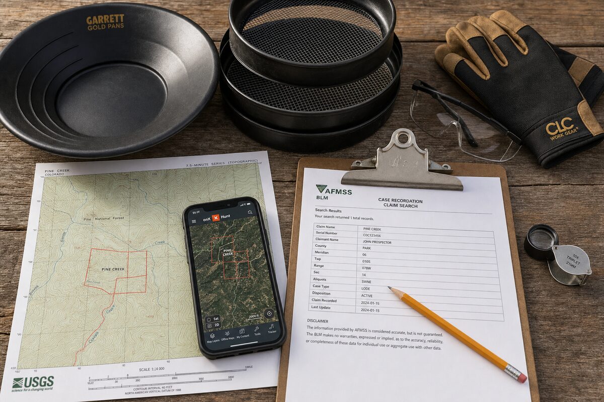
1. Verify current claim status before you leave home.
- Open onX Hunt (or Backcountry / Offroad Elite tier) and mark your target parcels.
- Cross-check MyLandMatters.org for active BLM mining claims — the layer onX doesn’t show by default.
- If in doubt, run the specific PLSS section-township-range through BLM LR2000 at reports.blm.gov/reports/LR2000. This is the authoritative record.
2. Check current PSICC alerts.
The South Park Ranger District maintains a live alerts page at fs.usda.gov/r02/psicc/alerts. Current active closures include the Eagle Rock and Observatory Rock area (in effect January 1 through July 31 each year, 2026 through 2031, for special biological communities). Those specific closures are in South Park south of Jefferson and won’t affect Michigan Creek drainage, but every trip should include a fresh check of the alerts page.
3. Base out of a public campground.
Two solid options in the immediate area:
- Michigan Creek Campground — 4 miles NW of Jefferson via CR 35 and CR 54. 12 sites, first-come first-serve, $22/night, mid-May through mid-October. Elevation 10,100 ft. Vault toilets, no water, no trash service. Best base camp for Michigan Creek exploration.
- Jefferson Creek Campground — On CR 37 in the Jefferson Lake Recreation Area. Reservable via Recreation.gov. Good base for Jefferson Creek and Jefferson Lake area.
- Aspen and Lodgepole — Two more Jefferson Lake Recreation Area campgrounds nearby.
4. Pick your window.
- Late June to mid-July: Snowmelt is peaking, water is running high and dirty. Difficult to read the creek.
- Late July through early October: Prime window. Water clears, bedrock exposed, weather stable until monsoons hit.
- Late October to early November: Cold but productive. Fewer people. Bring layers.
- November through May: Georgia Pass Road (which crosses the top of the Michigan Creek drainage) is closed November 23 through May 20. Winter access is limited to the lower approaches from US 285.
5. Read the creek.
Standard placer reading rules apply. Look for:
- Inside bends where the current slows
- Downstream of large boulders and bedrock outcrops — natural gold traps
- Bedrock crevices and cracks in the exposed stream bottom
- The clay layer just above bedrock in gravel banks
- False bedrock — a hard-packed clay or hardpan layer within the gravel that stops gold from dropping further
Test pans first. Move on if two or three consecutive pans show nothing. Concentrate where you get color.
6. Fill your holes and pack out everything.
The reason Jefferson-area collecting is still legal is because generations of prospectors haven’t trashed the place. Don’t be the person who ends the streak.
What Not To Do
A few things that will get you in real trouble:
- Don’t drive off designated roads. The PSICC’s Motorized Travel Management (MVUM) rules are actively enforced. If a road isn’t on the MVUM, you can’t drive it.
- Don’t work above the high-water mark. Below the mark is Casual Use. Above it involves surface disturbance that needs a permit.
- Don’t cross onto private inholdings. Park County has significant private land tucked inside the National Forest boundary. onX will show you these, but only if you check.
- Don’t touch anything historic. Old cabins, tailings piles, timbers, tools — leave them. Historic mining features on Forest Service land are federally protected under the Antiquities Act and the Archaeological Resources Protection Act.
- Don’t enter abandoned mines. The Jefferson area has old workings scattered through it. They’re deadly. Bad air, rotted timbers, undetonated blasting caps, radon. Look, photograph, walk away.
The Bigger Picture
The Jefferson area is a lot like the Fairplay dredge tailings area we covered earlier — a historic placer district with a small window of legal recreational access surrounded by heavily claimed ground. What makes Jefferson different is that the Town of Fairplay has an organized gold panning permit system for its dedicated stretch, while the Jefferson area has no equivalent municipal setup. You’re navigating the Forest Service, the BLM, and private claim holders on your own.
That’s not a problem if you do your homework. It’s a serious problem if you don’t.
For the broader Park County geology and the district’s connection to Colorado’s mining history, our Park County Minerals post sets the geological stage. For the fundamentals of the legal framework, Mining Claims 101 breaks down Casual Use, Notice of Intent, and Plan of Operations. And for the tools that make navigation on the ground possible, Hobby Mining Getting Started covers the onX / MyLandMatters / LR2000 stack.
Questions about the Jefferson area or planning a first trip? Get in touch.