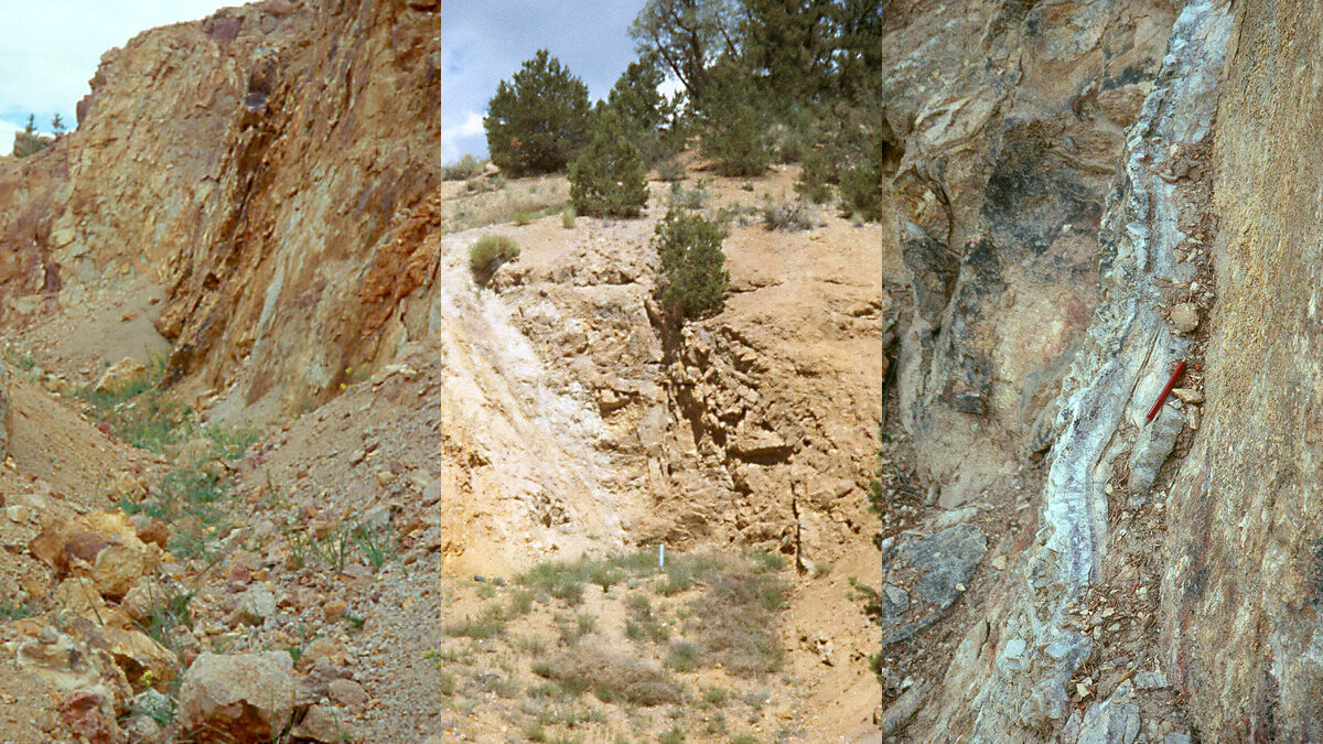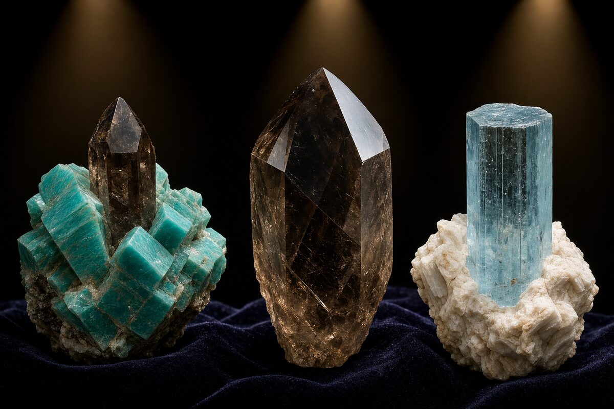
Mount Antero Aquamarine: Reading Colorado's Highest Gem Pegmatites
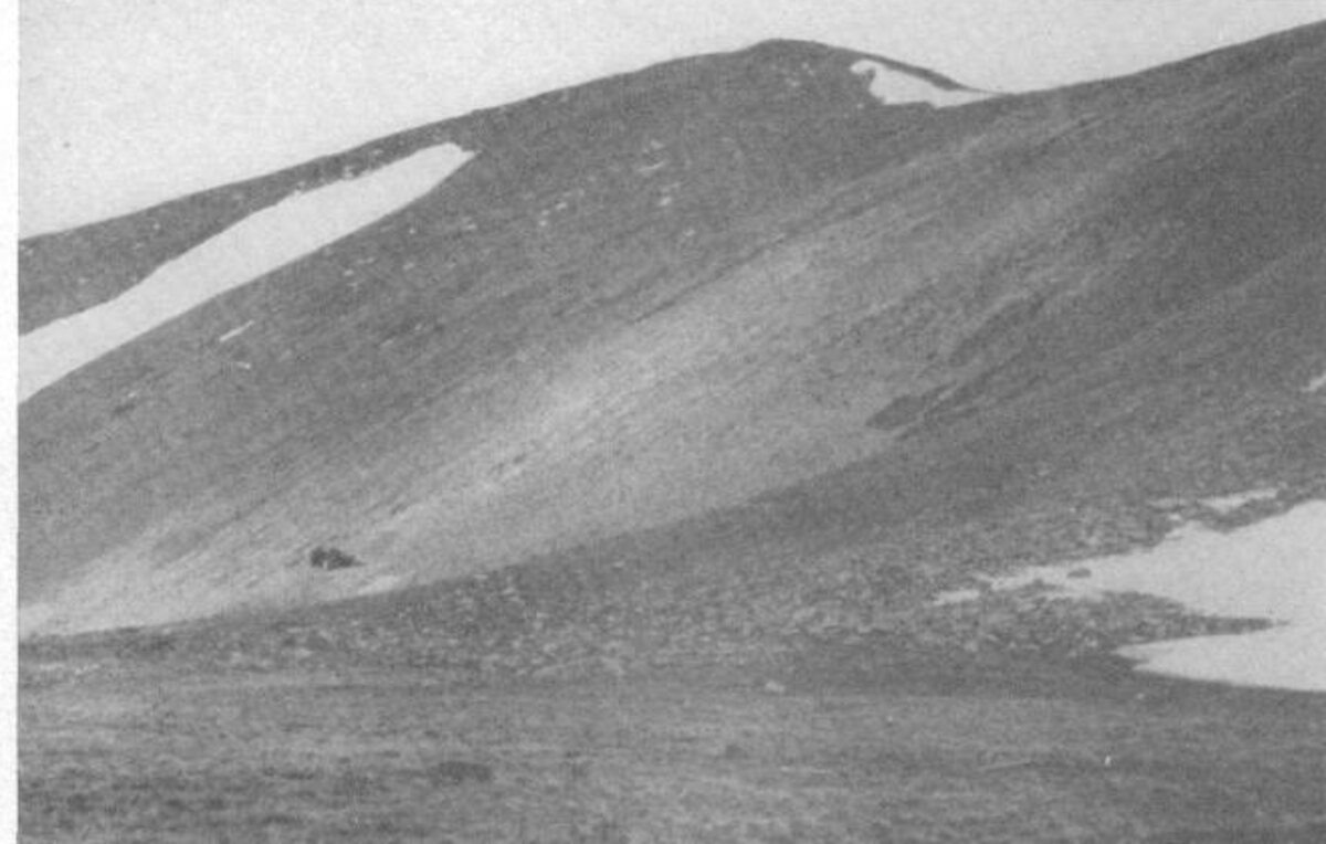
Mount Antero is not a casual roadside rockhounding stop. The summit reaches 14,269 feet, much of the aquamarine-bearing outcrop sits around 13,000 feet, the upper road requires high-clearance four-wheel drive, and many of the productive exposures are covered by claims that require permission.
It is also one of North America’s great mineral localities. Colorado’s official state gemstone occurs here as blue beryl in small, volatile-rich pegmatites and open cavities within the Oligocene Mount Antero Granite.
This guide explains the geology, the field clues, and the access reality without pretending that every pale-blue chip in the talus is an open invitation to dig.
First Correction: The Granite Is Not Precambrian
Older descriptions sometimes blur the age of Mount Antero’s host rocks. The surrounding Sawatch Range includes ancient Precambrian basement, but the Mount Antero Granite itself is Oligocene, about 29.6 million years old based on modern ⁴⁰Ar/³⁹Ar dates.
The Mount Antero Granite is a late, chemically evolved intrusion within the larger Mount Princeton batholith. It is generally light colored and rich in feldspar and quartz, with scattered biotite and smoky quartz. The gem-bearing pegmatites and cavities mainly cut the granite itself.
That distinction matters. The aquamarine is tied to the youngest evolved granite and its late-stage fluids, not to every old gneiss or granite boulder on the mountain.
Why Pegmatites Make Large Crystals
As a granitic magma cools, early minerals remove common elements from the melt. Water, fluorine, beryllium, and other incompatible components become concentrated in the remaining fluid-rich material.
That final fraction can form pegmatites—coarse-grained bodies dominated by feldspar, quartz, and mica. Where gas and fluid pressure leaves open space, miarolitic cavities form. Crystals projecting into those cavities can grow clean faces and terminations rather than being locked against neighboring grains.
At Mount Antero, most pegmatites are small. Historic USGS work describes many as a few inches wide and only a few feet long. Most are interlocked rock with little or no open cavity. The rare cavities are what produced the famous specimens.
Pocket versus non-pocket pegmatite
| Field feature | Non-pocket pegmatite | Miarolitic pocket zone |
|---|---|---|
| Texture | Interlocking feldspar, quartz, mica | Open void or clay-filled cavity |
| Beryl | Commonly frozen into matrix and translucent | Projects into open space; may be clear and terminated |
| Quartz | Massive or intergrown | Smoky crystals with free faces |
| Feldspar | Blocky interlocking grains | Euhedral microcline/perthite and albite lining the void |
| Collector potential | Mostly study material | Possible gem and specimen material |
Myth check: Coarse pegmatite does not guarantee a pocket. Most coarse bodies never developed the open space needed for gem crystals.
The Mount Antero Mineral Sequence
Classic work by George Switzer and the USGS describes a general sequence in the pocket-bearing system:
- Microcline/perthite
- Beryl, including aquamarine
- Smoky quartz
- Muscovite
- Phenakite
- Albite
- Fluorite
- Bertrandite and other late alteration minerals
The sequence is not identical in every cavity, but it gives you a way to read a broken pocket. Early feldspar and beryl may be partly etched or overgrown by later minerals. Bertrandite can form through late alteration of beryl. Fluorite and albite commonly represent cooler late-stage growth.
Other documented minerals include topaz, garnet, apatite, calcite, magnetite, limonite, ilmenorutile, and rare accessory species.
Aquamarine in the Field
Aquamarine is the blue to blue-green gem variety of beryl, Be₃Al₂Si₆O₁₈. Iron in different structural sites creates the color.
Identification checklist
- Habit: Six-sided prismatic crystals, commonly elongated
- Hardness: 7.5–8; scratches quartz and resists a steel knife
- Cleavage: Poor, unlike fluorite or feldspar
- Luster: Vitreous on clean crystal faces
- Streak: White
- Color: Pale greenish blue through clear sky blue; color alone is not diagnostic
- Fracture: Uneven to conchoidal
Quartz is the common look-alike. Both are hard and glassy. Beryl’s hexagonal prism, flatter termination, and different cross-section are stronger clues than color.
Matrix beryl versus gem aquamarine
Beryl frozen into solid pegmatite is commonly cloudy or translucent because it grew against other minerals. The clearest gem crystals grew freely into open cavities. This is why finding blue beryl in matrix is geologically useful but does not automatically mean you found facet-grade aquamarine.
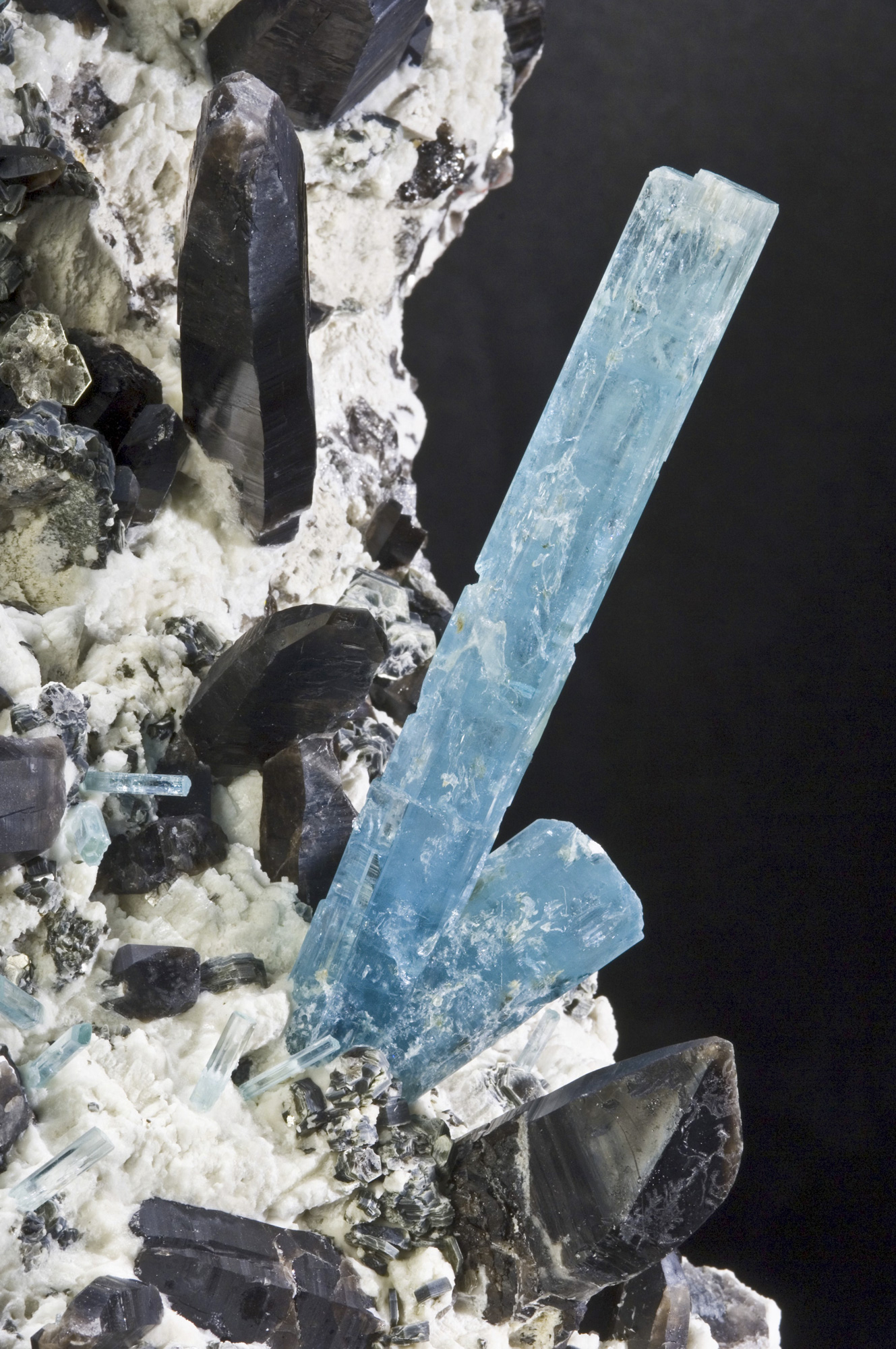
Real Mount Antero Specimens
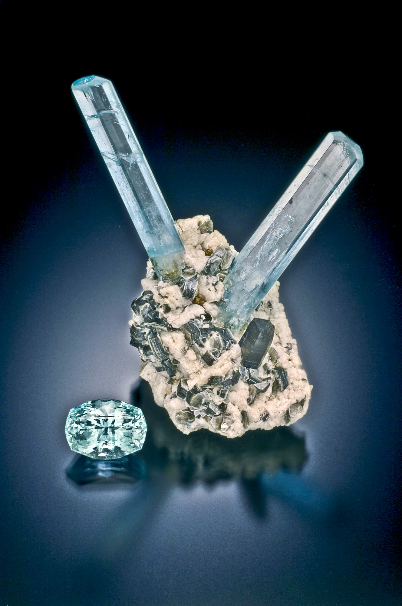
The specimen illustrates the pocket association: pale-blue hexagonal beryl, light feldspar and albite, silvery mica, and dark smoky quartz.
Float, Talus, and Pocket Clues
Freeze-thaw weathering breaks pegmatite and pocket material from the high slopes. Loose fragments move downslope through talus and shallow soil.
Float can help point uphill toward a source, but it is not a straight-line arrow. Frost heave, slope wash, snow movement, human digging, and old mine dumps can redistribute fragments.
Useful observations:
- Record the highest elevation where a mineral first appears
- Separate angular local fragments from rounded transported pieces
- Note repeated associated minerals rather than one isolated blue chip
- Look for fresh granite fragments carrying the same feldspar–smoky quartz–mica assemblage
- Compare float concentration across a slope instead of following one piece
Do not dismantle talus blindly. The mountain has fragile alpine soils, active mining areas, hikers below, and steep slopes where loose rock becomes a hazard.
Access in 2026: Road, Claims, and Permission
The official Forest Service page lists Mount Antero as open and gives an elevation of 14,269 feet. It also states that the upper road is rocky and rough and requires high-clearance four-wheel drive.
The normal access is:
- From Buena Vista, drive south on U.S. 285
- Turn west near Nathrop on County Road 162
- Continue roughly 12.5 miles toward the Baldwin Gulch/Mount Antero trailhead
- Forest Road 277 climbs toward Baldwin Lake and the upper mountain
The Forest Service states that four-wheel drive or an ATV is a must for the rough Baldwin Lake road and that vehicles must remain on designated routes to protect alpine tundra. Check the current Motor Vehicle Use Map and conditions before leaving.
The claim reality
The Colorado Geological Survey states that much of the aquamarine-bearing outcrop is claimed by private entities and cannot be accessed without permission.
Before collecting:
- Check current federal claims in BLM MLRS
- Check Chaffee County assessor and recorder records for patented/private parcels
- Carry the current Forest Service Motor Vehicle Use Map
- Obtain written claim-holder or landowner permission
- Confirm the exact collection rules with the Salida Ranger District
Public National Forest surface does not erase an active mineral claim. An old prospect pit, unattended equipment, or lack of signs does not make the minerals available.
Is There a Public Mine Tour or Fee Dig?
Mount Antero does not operate like a public show mine with a walk-up ticket counter. Commercial and guided trips change over time, and some outfitters provide transportation or access only through agreements with individual claim holders.
Before paying anyone:
- Ask which claim or parcel the trip uses
- Ask whether collecting permission is written
- Confirm exactly what participants may keep
- Verify whether transportation, guide service, or actual digging access is included
- Check cancellation rules for weather and road closures
Do not rely on an old television episode, social-media post, or decade-old fee-dig listing as proof of current access.
High-Altitude Safety Is the First Filter
Most productive ground is around 13,000 feet. The aquamarine may be beautiful; the environment is indifferent.
Lightning
Summer storms can build quickly. The Forest Service says to leave ridges and high terrain immediately when thunder is heard and remain sheltered for 30 minutes after the final thunderclap.
Start early enough to be descending before typical afternoon convection. A vehicle on an exposed upper road is not a substitute for conservative weather decisions.
Altitude
Headache, nausea, dizziness, unusual fatigue, poor coordination, and shortness of breath can signal altitude illness. Descending is the reliable response when symptoms worsen. Do not let the possibility of a pocket override judgment.
Terrain and traffic
- Loose talus can move underfoot or strike people below
- Mining cuts can collapse
- Upper-road passing space is limited
- ATVs, Jeeps, hikers, and mining equipment may share the route
- Snow, hail, and high wind can occur during summer
Travel with another person, carry navigation and emergency communication, and tell someone your route and return time.
A Better Mount Antero Field Plan
Before the trip
- Verify claim and ownership status
- Contact the Salida Ranger District
- Download the current MVUM and offline topographic map
- Check the high-elevation weather forecast
- Set a firm turnaround time
- Prepare for cold, wind, hail, and sun
In the field
- Stay on designated roads and trails
- Respect claim boundaries and active operations
- Photograph context before moving loose material
- Record elevation, slope position, host rock, and mineral association
- Wrap aquamarine and fluorite separately
- Do not enter workings or undermine cuts
- Backfill any authorized disturbance
After the trip
- Label specimens with precise, non-sensitive locality data
- Photograph crystal habit and matrix
- Compare finds with the CGS and USGS mineral lists
- Do not publish private claim coordinates without the holder’s permission
What This Locality Teaches
Mount Antero is more than a famous blue crystal locality. It is a clean lesson in late-stage magmatic evolution:
- A young evolved granite concentrates beryllium and volatile components
- Small pegmatites form throughout the stock
- Rare open cavities create space for terminated crystals
- Cooling hydrothermal fluids add albite, fluorite, phenakite, and alteration minerals
- Uplift and freeze-thaw expose and redistribute pocket material
The mountain also teaches the non-geologic half of modern prospecting: productive ground is claimed, alpine access is fragile, and legal permission matters as much as mineral identification.
Sources and Further Reading
- Colorado Geological Survey: Gemstones
- USGS Bulletin 982-D: Beryllium Deposits of the Mount Antero Region
- USGS Professional Paper 289: Geology and Ore Deposits of the Garfield Quadrangle
- USGS Geolex: Mount Antero Granite
- USGS geochronology data for Mount Antero Granite
- USFS: Mount Antero Fourteener
- USFS: Baldwin Lake and Forest Road 277
- USFS: Lightning Safety
- Colorado Geological Survey: Prospecting
For the fundamentals behind pegmatites, float, field tests, maps, claims, and land access, start the free Colorado Field Geology for Prospectors course.